| |
Our first objective once we reached the Smithsonian research station on Carrie Bow Caye was to relocate our target sites and tagged shallow corals from our trip in March 2014. There are three reef sites: Raph's Wall, South Reef, and Tobacco Caye, each with a shallow (55ft) and mesophotic (130ft) set of data loggers deployed on cinderblocks. The cinderblocks served as the focal point for the tagged corals and GPS location, and were therefore left in place once the original data loggers were recovered in August 2014. To read more about each of the sites' reef layout, see our previous blog posts here.
Relocating these sites proved to be more difficult than anticipated. The original GPS points were based on the deep cinderblocks, where we deployed a surface marker on a line during the dive, and then recorded the GPS coordinates on the surface in the boat. Since the sites are on steep reef walls with overhanging ledges, corals, and sponges, we had to pull the marker out from the wall to avoid snags and hope that we were still directly over the site. We suspect by the fact that our original points were so off that this method of site location was in fact inaccurate.
Therefore, we spent the first dives at each site exploring the shallow reef crest and deep walls to find the cinderblocks, redeploy new data loggers, and collect accurate GPS coordinates based on the shallow part of the site. Next, we used the maps made in March 2014 to find all of the shallow Montastraea cavernosa colonies that were tagged with cattle tags. High algal overgrowth made this task difficult, however, we were able to locate all of the shallow corals with the exception of one which had likely died (out of 45 colonies). In the surviving corals, the majority showed a healthy appearance and colony growth, with a few cases of algal overgrowth and bleaching.
Our next steps are to resample these same tagged corals and to explore and sample the same coral species on the deep reefs.
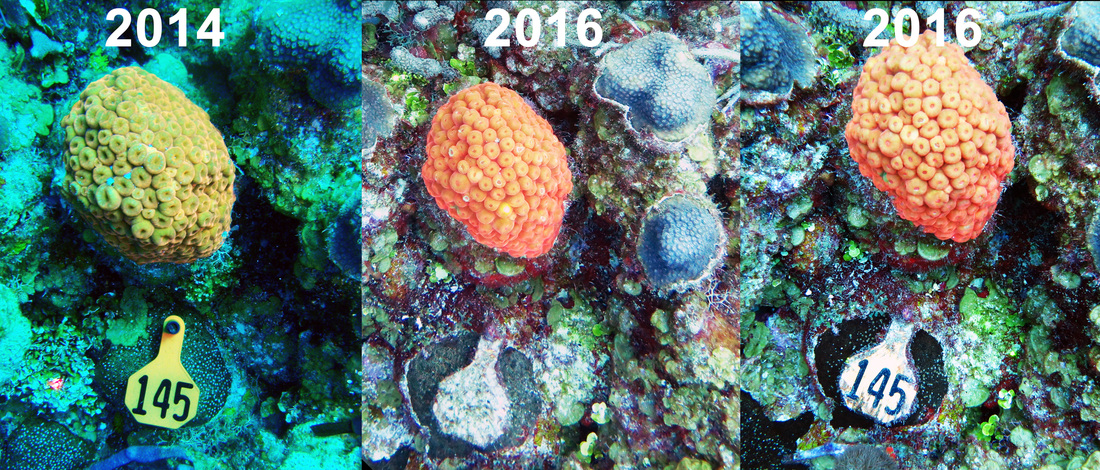
A timeline of an orange morph of Montastraea cavernosa tagged as #145. Photos from 2014, 2016 before tag cleaning, and 2016 after tag cleaning
